|
search place name
|
||
Kuliga (Orlovskaya Oblast', Russia)Kuliga is a town in the Orlovskaya Oblast' region of Russia. An overview map of the region around Kuliga is displayed below.
regional and 3d topo map of Kuliga, Russia ::

Kuliga airports ::
The nearest airport is BZK - Bryansk, located 106.0 km west of Kuliga.
Nearby towns ::
Kotova (1.1km south east) //
Maloye Titovo (2.1km south east) //
Talyzino (3.2km north west) //
Naryshkino (4.4km south) //
Kitovskiy (4.3km north) //
Solntsevo (4.2km north west) //
Titovo (3.2km east) //
Bol'shoy Rog (3.4km south west) //
Postnikovo (5.1km north) //
Ser'govskiy (4.1km south east) //
Titovo-Matyko (3.9km south east) //
Melynki (3.6km east) //
Vasil'yevskiy (5.3km north east) //
Sergiyevskoye (4.1km east) //
Pogorelets (6.5km north) //
Sopova (5.8km north west) //
Podzavalovo (6.5km north west) //
Verkhnyaya Bogdanovka (8.4km south) //
Prigozhevskiy (5.7km north east) //
Dmitrovka (7.8km north east) //
Georgiyevskiy (7.8km south east) //
Bibikovo (7.6km north west) //
Vtoroye Muratovo (8.0km north west) //
Aleksandrovka (9.2km south west) //
Muratovo (8.4km north west) //
[all distances 'as the bird flies' and approximate] 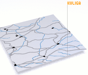 Places with similar names to Kuliga, Russia ::
Disclaimer :: Information on this page comes without warranty of any kind |
||
|
Where is Kuliga? Elevation and coordinates ::
Latitude (lat): 53°0'32"N Longitude (lon): 35°43'19"E
Elevation (approx.): 177m (map arrows pan, magnifying glasses zoom) |
||
|
Visiting Kuliga? Hotel/Accommodation ::
Book a hotel in Kuliga Travel Guide ::
Buy a travel guide for Russia rental cars ::
car rental offers GPS waypoint ::
download a GPX waypoint (PoI) of Kuliga for your GPS receiver
|
||