|
search place name
|
||
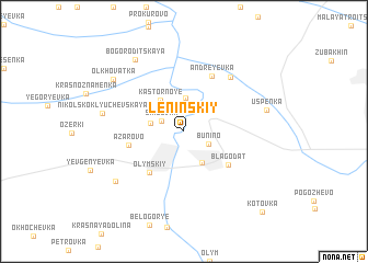
Leninskiy (Kurskaya Oblast', Russia)Leninskiy is a town in the Kurskaya Oblast' region of Russia. An overview map of the region around Leninskiy is displayed below.
regional and 3d topo map of Leninskiy, Russia ::
Leninskiy airports ::
The nearest airport is VOZ - Voronezh Chertovitskoye, located 74.6 km east of Leninskiy.
Nearby towns ::
Shilovka (1.8km north west) //
Bunino (2.0km south east) //
Zarechnyy (3.5km north) //
Dmitriyevka (2.3km west) //
Kastornaya Novaya (3.3km south) //
Kastornoye (3.5km north west) //
Olymskiy (4.7km south west) //
Blagodat' (4.4km south east) //
Azarovo (3.7km west) //
Andreyevka (5.9km north) //
Znamya Arkhangel'skaya (6.2km north east) //
Nikol'sko-Klyuchevskaya (5.5km west) //
Novodvorskiy (6.7km south west) //
Uspenka (5.7km north east) //
Bogoroditskaya (7.9km north west) //
Ol'khovatka (6.9km north west) //
Kotovka (9.6km south east) //
[all distances 'as the bird flies' and approximate] 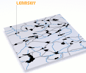 Places with similar names to Leninskiy, Russia ::
Disclaimer :: Information on this page comes without warranty of any kind |
||
|
Where is Leninskiy? Elevation and coordinates ::
Latitude (lat): 51°48'8"N Longitude (lon): 38°8'54"E
Elevation (approx.): 167m (map arrows pan, magnifying glasses zoom) |
||
|
Visiting Leninskiy? Hotel/Accommodation ::
Book a hotel in Leninskiy Travel Guide ::
Buy a travel guide for Russia rental cars ::
car rental offers GPS waypoint ::
download a GPX waypoint (PoI) of Leninskiy for your GPS receiver
|
||