|
search place name
|
||
Lyuboneg (Pskovskaya Oblast', Russia)Lyuboneg is a town in the Pskovskaya Oblast' region of Russia. An overview map of the region around Lyuboneg is displayed below.
regional and 3d topo map of Lyuboneg, Russia ::

Lyuboneg airports ::
The nearest airport is LED - St. Petersburg Pulkovo, located 210.1 km north of Lyuboneg.
Nearby towns ::
Novoye Selo (1.0km east) //
Krasnyye Dolzhitsy (2.1km north east) //
Staroye Selo (2.6km south east) //
Novo-Deti (4.2km north west) //
Lukomo (2.8km west) //
Fal'ki (3.5km north east) //
Kostsy (5.9km north) //
Valuy (3.6km west) //
Zamoshki (5.2km south west) //
Gachki (4.6km south east) //
Kamenka (7.4km south) //
Dorogostitsy (7.5km north) //
Lemenka (6.5km north east) //
Zapol'ye (7.7km north) //
Bessolovo (5.4km south west) //
Kamenka (8.0km north) //
Ramen'ye (6.8km south west) //
Gorki (8.6km north) //
Gorodishche (8.2km north west) //
Gremok (8.9km north east) //
[all distances 'as the bird flies' and approximate] 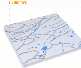
Disclaimer :: Information on this page comes without warranty of any kind |
||
|
Where is Lyuboneg? Elevation and coordinates ::
Latitude (lat): 57°55'0"N Longitude (lon): 30°5'0"E
Elevation (approx.): 67m (map arrows pan, magnifying glasses zoom) |
||
|
Visiting Lyuboneg? Hotel/Accommodation ::
Book a hotel in Lyuboneg Travel Guide ::
Buy a travel guide for Russia rental cars ::
car rental offers GPS waypoint ::
download a GPX waypoint (PoI) of Lyuboneg for your GPS receiver
|
||