|
search place name
|
||
Magar (Dagestan, Russia)Magar is a town in the Dagestan region of Russia. An overview map of the region around Magar is displayed below.
regional and 3d topo map of Magar, Russia ::

Magar airports ::
The nearest airport is MCX - Makhachkala Uytash, located 96.0 km north east of Magar.
Nearby towns ::
Tseneb (1.3km north) //
Chunib (1.7km north west) //
Khurukh (1.8km south east) //
Mukutl' (1.9km east) //
Khinub (2.7km south west) //
Khetsub (2.4km east) //
Sodab (3.3km north west) //
Tsurib (4.5km north) //
Moshob (3.9km north west) //
Irib (4.3km south west) //
Mogrob (4.7km south east) //
Baginub (4.1km south east) //
Gidib (4.7km north west) //
Chvadab (5.4km south east) //
Rul'dab (5.2km south west) //
Nukush (5.8km south west) //
Kuchrab (5.6km south east) //
Kosroda (7.2km south) //
Mugurukh (7.5km north) //
Karanub (8.2km south) //
Doronub (8.3km south) //
Dusrakh (8.2km south east) //
Tlyarobazutl' (8.0km south west) //
Kutikh (8.7km south west) //
Chanab (9.4km south east) //
Chil'dab (9.0km south east) //
Nakazukh (9.8km north east) //
Gilib (10.2km south west) //
Gochada (10.5km north west) //
[all distances 'as the bird flies' and approximate] 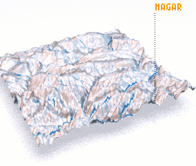 Places with similar names to Magar, Russia ::
Disclaimer :: Information on this page comes without warranty of any kind |
||
|
Where is Magar? Elevation and coordinates ::
Latitude (lat): 42°11'43"N Longitude (lon): 46°50'24"E
Elevation (approx.): 1504m (map arrows pan, magnifying glasses zoom) |
||
|
Visiting Magar? Hotel/Accommodation ::
Book a hotel in Magar Travel Guide ::
Buy a travel guide for Russia rental cars ::
car rental offers GPS waypoint ::
download a GPX waypoint (PoI) of Magar for your GPS receiver
|
||