|
search place name
|
||
Malaya Samarka (Orlovskaya Oblast', Russia)Malaya Samarka is a town in the Orlovskaya Oblast' region of Russia. An overview map of the region around Malaya Samarka is displayed below.
regional and 3d topo map of Malaya Samarka, Russia ::

Nearby towns ::
Pogranichnyy (0.0km north) //
Nikol'skaya (1.9km north) //
Goncharovy Dvory (2.2km south east) //
Chernogryazka (2.2km west) //
Leninskiy (3.9km south) //
Utrennyaya Zarya (2.9km north east) //
Zhuravets (4.3km south west) //
Sov'i Lapki (4.3km south east) //
Verkhneye Skvorcheye (5.1km north) //
Baranovka (5.7km south) //
Protasovo (5.6km south) //
Doly (5.9km north) //
Khitrovo (6.0km north) //
Krikunovo (4.5km east) //
Saburovo (7.5km south) //
Rannyaya Zarya (4.9km west) //
Malyy Rzhavets (7.0km south) //
Verkhneye Skvorcheye (7.5km north) //
Zhelanovka (7.7km south) //
Semichastnoye (5.8km south west) //
Gorelyy (7.7km north) //
Mavrino (7.1km south east) //
Vtoroye Teter'yë (8.7km south west) //
Kotëlki (8.7km north west) //
Vzaimopomoshch' (9.8km south east) //
[all distances 'as the bird flies' and approximate] 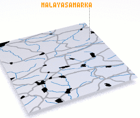 Places with similar names to Malaya Samarka, Russia :: Disclaimer :: Information on this page comes without warranty of any kind |
||
|
Where is Malaya Samarka? Elevation and coordinates ::
Latitude (lat): 52°44'0"N Longitude (lon): 36°54'0"E
Elevation (approx.): 244m (map arrows pan, magnifying glasses zoom) |
||
|
Visiting Malaya Samarka? Hotel/Accommodation ::
Book a hotel in Malaya Samarka Travel Guide ::
Buy a travel guide for Russia rental cars ::
car rental offers GPS waypoint ::
download a GPX waypoint (PoI) of Malaya Samarka for your GPS receiver
|
||