|
search place name
|
||
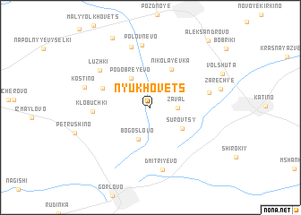
Nyukhovets (Ryazanskaya Oblast', Russia)Nyukhovets is a town in the Ryazanskaya Oblast' region of Russia. An overview map of the region around Nyukhovets is displayed below.
regional and 3d topo map of Nyukhovets, Russia ::
Nyukhovets airports ::
The nearest airport is VKO - Moscow Vnukovo, located 218.8 km north west of Nyukhovets.
Nearby towns ::
Zaval (2.0km east) //
Bogoslovo (4.1km south) //
Podobreyevo (3.9km north) //
Surovtsy (3.5km south east) //
Nikolayevka (5.0km north) //
Kadushino (4.3km north west) //
Klobuchki (4.3km west) //
Krasnyy May (4.7km north east) //
Luzhki (5.9km north west) //
Polovnevo (7.8km north) //
Dmitriyevo (7.8km south) //
Butyrki (7.7km north) //
Kostino (5.5km north west) //
Zarech'ye (5.7km north east) //
Shchegolëvo (9.1km north) //
Aleksandrovo (9.3km north east) //
[all distances 'as the bird flies' and approximate]  Places with similar names to Nyukhovets, Russia :: Disclaimer :: Information on this page comes without warranty of any kind |
||
|
Where is Nyukhovets? Elevation and coordinates ::
Latitude (lat): 53°55'47"N Longitude (lon): 39°4'33"E
Elevation (approx.): 197m (map arrows pan, magnifying glasses zoom) |
||
|
Visiting Nyukhovets? Hotel/Accommodation ::
Book a hotel in Nyukhovets Travel Guide ::
Buy a travel guide for Russia rental cars ::
car rental offers GPS waypoint ::
download a GPX waypoint (PoI) of Nyukhovets for your GPS receiver
|
||