|
search place name
|
||
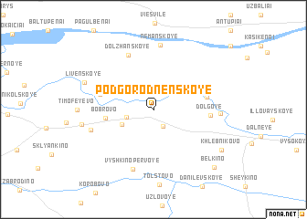
Podgorodnenskoye (Kaliningradskaya Oblast', Russia)Podgorodnenskoye is a town in the Kaliningradskaya Oblast' region of Russia. An overview map of the region around Podgorodnenskoye is displayed below.
regional and 3d topo map of Podgorodnenskoye, Russia ::
Podgorodnenskoye airports ::
The nearest airport is KGD - Kaliningrad Khrabrovo, located 115.1 km west of Podgorodnenskoye.
Nearby towns ::
Polyanskoye (2.2km south) //
Abramovo (2.1km south west) //
Vyshkino (2.9km south west) //
Bobrovo (3.5km west) //
Zelenoles'ye (4.0km east) //
Livenskoye (4.2km north west) //
Dolgoye (4.1km east) //
Dolzhanskoye (6.8km north) //
Vyshkino Pervoye (7.5km south) //
Nemanskoye (7.9km north) //
Sadovo (5.1km south west) //
Udarnoye (4.7km east) //
Alekseyevka (5.3km west) //
Livenskoye (5.8km north west) //
Khlebnikovo (6.9km south east) //
Belkino (8.3km south east) //
[all distances 'as the bird flies' and approximate] 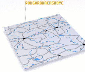 Places with similar names to Podgorodnenskoye, Russia :: Disclaimer :: Information on this page comes without warranty of any kind |
||
|
Where is Podgorodnenskoye? Elevation and coordinates ::
Latitude (lat): 54°58'47"N Longitude (lon): 22°22'56"E
Elevation (approx.): 22m (map arrows pan, magnifying glasses zoom) |
||
|
Visiting Podgorodnenskoye? Hotel/Accommodation ::
Book a hotel in Podgorodnenskoye Travel Guide ::
Buy a travel guide for Russia rental cars ::
car rental offers GPS waypoint ::
download a GPX waypoint (PoI) of Podgorodnenskoye for your GPS receiver
|
||