|
search place name
|
||
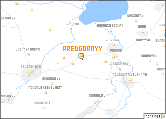
Predgornyy (Krasnodarskiy Kray, Russia)Predgornyy is a town in the Krasnodarskiy Kray region of Russia. An overview map of the region around Predgornyy is displayed below.
regional and 3d topo map of Predgornyy, Russia ::
Predgornyy airports ::
The nearest airport is KRR - Krasnodar Pashkovskiy, located 35.5 km north east of Predgornyy.
Other airports nearby include AER - Sochi (184.2 km south east), Nearby towns ::
Naumenkov (2.0km south west) //
Bonchkovskiy (2.7km north west) //
Bondarenko (3.2km west) //
Rashpil' (3.7km east) //
Volikov (4.1km west) //
Vodokachka (4.9km east) //
Kovalenko (7.2km north) //
Afipskiy (5.9km north east) //
Prishib (5.5km east) //
Vostochnyy (6.2km east) //
Svobodnyy (7.4km south west) //
Novobzhegokay (7.9km north east) //
Kosharskiy (8.6km north west) //
Novoalekseyevskiy (9.5km south west) //
[all distances 'as the bird flies' and approximate]  Places with similar names to Predgornyy, Russia ::
// Pôrto Guarani (BR)
// Pǝrdiqıran (AZ)
// Perdikárion (GR)
// Port Crane (US)
// Predgornoe (KZ)
// Puerto Guaraní (PY)
// Puerto Carreño (CO)
// Predgornyy (RU)
// Predgornyy (RU)
// Predgornyy (RU)
Disclaimer :: Information on this page comes without warranty of any kind |
||
|
Where is Predgornyy? Elevation and coordinates ::
Latitude (lat): 44°52'30"N Longitude (lon): 38°46'51"E
Elevation (approx.): 32m (map arrows pan, magnifying glasses zoom) |
||
|
Visiting Predgornyy? Hotel/Accommodation ::
Book a hotel in Predgornyy Travel Guide ::
Buy a travel guide for Russia rental cars ::
car rental offers GPS waypoint ::
download a GPX waypoint (PoI) of Predgornyy for your GPS receiver
|
||