|
search place name
|
||
Prilutskoye (Vologodskaya Oblast', Russia)Prilutskoye is a town in the Vologodskaya Oblast' region of Russia. An overview map of the region around Prilutskoye is displayed below.
regional and 3d topo map of Prilutskoye, Russia ::

Nearby towns ::
Piterskaya (3.8km south) //
Chushevitsy (2.5km east) //
Petukhovskaya (5.6km south) //
Novoderevskaya (4.6km north west) //
Novaya Derevnya (5.0km north west) //
Lipenskiy Pogost (7.4km south) //
Kamenka (5.3km south east) //
Mysovskaya (4.1km north west) //
Ratino (6.2km north west) //
Ivanino (6.2km south west) //
Leushinskaya (7.9km south) //
Moseyevskaya (5.2km south east) //
Rostovskaya (4.5km south west) //
Svetil'novo (8.5km south) //
[all distances 'as the bird flies' and approximate] 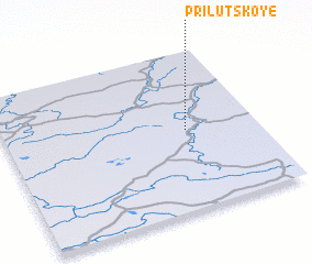 Places with similar names to Prilutskoye, Russia ::
// Prilutskoye (RU)
Disclaimer :: Information on this page comes without warranty of any kind |
||
|
Where is Prilutskoye? Elevation and coordinates ::
Latitude (lat): 60°30'0"N Longitude (lon): 41°43'0"E
(map arrows pan, magnifying glasses zoom) |
||
|
Visiting Prilutskoye? Hotel/Accommodation ::
Book a hotel in Prilutskoye Travel Guide ::
Buy a travel guide for Russia rental cars ::
car rental offers GPS waypoint ::
download a GPX waypoint (PoI) of Prilutskoye for your GPS receiver
|
||