|
search place name
|
||
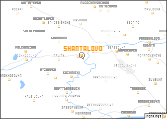
Shantalovo (Smolenskaya Oblast', Russia)Shantalovo is a town in the Smolenskaya Oblast' region of Russia. An overview map of the region around Shantalovo is displayed below.
regional and 3d topo map of Shantalovo, Russia ::
Shantalovo airports ::
The nearest airport is BZK - Bryansk, located 152.8 km south east of Shantalovo.
Other airports nearby include GME - Gomel (212.9 km south west), Nearby towns ::
Stomyatka (1.0km north west) //
Poluyevo (2.2km north east) //
Kuz'minichi (4.2km south) //
Naviny (3.3km west) //
Gaponovo (5.2km north west) //
Barsukovskiye (5.6km south east) //
Rogozhinskiye (5.6km south west) //
Berëzovka (4.7km north east) //
Osinovka (6.4km north east) //
Vas'kovo (8.0km north) //
Novyy Derebuzh (7.7km south) //
Ryzhëvka (5.7km south west) //
Zamostishche (8.1km north west) //
[all distances 'as the bird flies' and approximate] 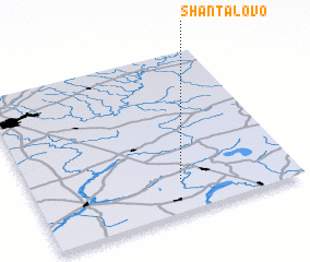 Places with similar names to Shantalovo, Russia ::
// Chintulovo (BG)
// Shandalovo (RU)
Disclaimer :: Information on this page comes without warranty of any kind |
||
|
Where is Shantalovo? Elevation and coordinates ::
Latitude (lat): 54°12'0"N Longitude (lon): 32°34'0"E
Elevation (approx.): 179m (map arrows pan, magnifying glasses zoom) |
||
|
Visiting Shantalovo? Hotel/Accommodation ::
Book a hotel in Shantalovo Travel Guide ::
Buy a travel guide for Russia rental cars ::
car rental offers GPS waypoint ::
download a GPX waypoint (PoI) of Shantalovo for your GPS receiver
|
||