|
search place name
|
||
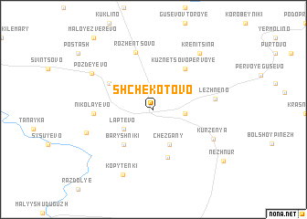
Shchëkotovo (Nizhegorodskaya Oblast', Russia)Shchëkotovo is a town in the Nizhegorodskaya Oblast' region of Russia. An overview map of the region around Shchëkotovo is displayed below.
regional and 3d topo map of Shchëkotovo, Russia ::
Nearby towns ::
Kuznetsovo Vtoroye (2.1km east) //
Laptëvo (3.1km south west) //
Chezgany (4.4km south) //
Baryshniki (4.7km south west) //
Kergany (5.9km south) //
Kuznetsovo Pervoye (5.4km north) //
Verkhneye Samoylovo (5.4km north) //
Toropovo (4.3km north west) //
Rozhentsovo (7.0km north) //
Nikolayevo (4.0km west) //
Lezhneno (4.3km east) //
Kurzenya (5.4km south east) //
Staraya Rudka (5.3km south west) //
Pozdeyevo (6.0km north west) //
Kopytenki (8.2km south) //
Krenitsina (7.5km north east) //
Nezhnur (7.9km south east) //
Maloye Zverevo (9.6km north west) //
[all distances 'as the bird flies' and approximate]  Places with similar names to Shchëkotovo, Russia ::
Disclaimer :: Information on this page comes without warranty of any kind |
||
|
Where is Shchëkotovo? Elevation and coordinates ::
Latitude (lat): 56°59'18"N Longitude (lon): 46°33'57"E
Elevation (approx.): 112m (map arrows pan, magnifying glasses zoom) |
||
|
Visiting Shchëkotovo? Hotel/Accommodation ::
Book a hotel in Shchëkotovo Travel Guide ::
Buy a travel guide for Russia rental cars ::
car rental offers GPS waypoint ::
download a GPX waypoint (PoI) of Shchëkotovo for your GPS receiver
|
||