|
search place name
|
||
Sigovka (Tverskaya Oblast', Russia)Sigovka is a town in the Tverskaya Oblast' region of Russia. An overview map of the region around Sigovka is displayed below.
regional and 3d topo map of Sigovka, Russia ::
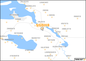
Nearby towns ::
Kalishche (1.3km north) //
Gorbovka (2.1km north west) //
Zales'ye (3.0km north) //
Anan'ino (3.5km south) //
Nizhniye Rudiny (2.9km north west) //
Bukovitsy (4.5km south) //
Rogozha (3.0km east) //
Verkhniye Rudiny (4.3km north west) //
Spitsino (5.5km south) //
Ostsy (3.9km south east) //
Mar'ino (6.3km north) //
Lokotets (6.9km north) //
Zorino (8.0km north) //
Kulatovo (8.4km south) //
Podlozh'ye (8.1km north) //
Verkhniye Kotitsy (6.6km south east) //
Soroga (9.0km north) //
Nizhniye Kotitsy (8.9km south east) //
[all distances 'as the bird flies' and approximate] 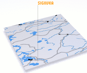 Places with similar names to Sigovka, Russia ::
Disclaimer :: Information on this page comes without warranty of any kind |
||
|
Where is Sigovka? Elevation and coordinates ::
Latitude (lat): 57°5'49"N Longitude (lon): 33°12'55"E
Elevation (approx.): 214m (map arrows pan, magnifying glasses zoom) |
||
|
Visiting Sigovka? Hotel/Accommodation ::
Book a hotel in Sigovka Travel Guide ::
Buy a travel guide for Russia rental cars ::
car rental offers GPS waypoint ::
download a GPX waypoint (PoI) of Sigovka for your GPS receiver
|
||