|
search place name
|
||
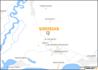
Sirenevka (Primorskiy Kray, Russia)Sirenevka is a town in the Primorskiy Kray region of Russia. An overview map of the region around Sirenevka is displayed below.
regional and 3d topo map of Sirenevka, Russia ::
Sirenevka airports ::
The nearest airport is VVO - Vladivostok Knevichi, located 15.4 km east of Sirenevka.
Nearby towns ::
Klyuchevoy (2.5km south) //
Mirnyy (4.1km south) //
Tayezhnyy (5.2km north) //
Morskoy (5.0km south west) //
Vol'no-Nadezhdinskoye (5.2km south east) //
Zapadnyy (7.7km south) //
Prokhladnoye (8.0km south east) //
[all distances 'as the bird flies' and approximate] 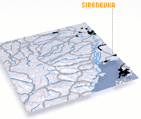 Places with similar names to Sirenevka, Russia ::
Disclaimer :: Information on this page comes without warranty of any kind |
||
|
Where is Sirenevka? Elevation and coordinates ::
Latitude (lat): 43°25'30"N Longitude (lon): 131°57'40"E
Elevation (approx.): 115m (map arrows pan, magnifying glasses zoom) |
||
|
Visiting Sirenevka? Hotel/Accommodation ::
Book a hotel in Sirenevka Travel Guide ::
Buy a travel guide for Russia rental cars ::
car rental offers GPS waypoint ::
download a GPX waypoint (PoI) of Sirenevka for your GPS receiver
|
||