|
search place name
|
||
Sitnikovo (Ivanovskaya Oblast', Russia)Sitnikovo is a town in the Ivanovskaya Oblast' region of Russia. An overview map of the region around Sitnikovo is displayed below.
regional and 3d topo map of Sitnikovo, Russia ::
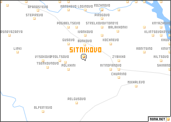
Nearby towns ::
Myazovo (2.1km north west) //
Serkovo (2.1km north west) //
Bun'kovo (3.5km north) //
Polkhini (2.7km south west) //
Tyuryukovo (2.4km west) //
Gusevo (4.2km north west) //
Zabolot'ye (4.2km north west) //
Ivan'kovo (5.6km north) //
Frol'tsovo (3.0km west) //
Mitrofanovo (3.5km south east) //
Strelkovo Pervoye (5.9km north) //
Kochnevo (4.8km north east) //
Zybikha (4.0km east) //
Kuligi (4.4km south east) //
Zales'ye (4.4km south east) //
Stepanovo (7.5km north) //
Strelkovo Vtoroye (7.7km north) //
Pogibel'tsevo (7.7km north) //
Chuprino (5.5km south east) //
Tserkovnovo (4.7km west) //
Balakhonki (7.6km north east) //
[all distances 'as the bird flies' and approximate] 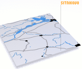 Places with similar names to Sitnikovo, Russia ::
// Stan'kovo (RU)
// Sten'kovo (RU)
// Stennikovo (RU)
// Stennikovo (RU)
// Sudnikovo (RU)
// Sudnikovo (RU)
// Zadnikovo (RU)
// Zadnikovo (RU)
// Stankova (UA)
// Sitnikov (KZ)
Disclaimer :: Information on this page comes without warranty of any kind |
||
|
Where is Sitnikovo? Elevation and coordinates ::
Latitude (lat): 57°2'0"N Longitude (lon): 40°42'0"E
Elevation (approx.): 148m (map arrows pan, magnifying glasses zoom) |
||
|
Visiting Sitnikovo? Hotel/Accommodation ::
Book a hotel in Sitnikovo Travel Guide ::
Buy a travel guide for Russia rental cars ::
car rental offers GPS waypoint ::
download a GPX waypoint (PoI) of Sitnikovo for your GPS receiver
|
||