|
search place name
|
||
Sloboda (Smolenskaya Oblast', Russia)Sloboda is a town in the Smolenskaya Oblast' region of Russia. An overview map of the region around Sloboda is displayed below.
regional and 3d topo map of Sloboda, Russia ::

Sloboda airports ::
The nearest airport is VTB - Vitebsk, located 94.6 km north west of Sloboda.
Nearby towns ::
Katyn'-Pokrovskoye (2.1km south east) //
Novoye Kuprino (3.3km north) //
Ladyzhitsy (2.1km east) //
Katyn' (2.1km east) //
Staro-Terpilovo (2.8km north east) //
Krasnaya Gorka (3.9km south) //
Budkovo (3.9km north) //
Staroye Kuprino (3.9km north) //
Borok (3.3km south east) //
Vonlyarovo (4.3km south west) //
Chekulino (4.5km south east) //
Motory (5.7km south) //
Yermaki (6.0km north) //
Chabury (7.4km north) //
Shkurkina (7.5km south) //
Tishino (6.7km north west) //
Gorokhova (8.1km south east) //
Mikhaylovka (7.0km south west) //
Shpaki (8.6km south east) //
[all distances 'as the bird flies' and approximate] 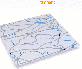 Places with similar names to Sloboda, Russia ::
Disclaimer :: Information on this page comes without warranty of any kind |
||
|
Where is Sloboda? Elevation and coordinates ::
Latitude (lat): 54°47'0"N Longitude (lon): 31°42'0"E
Elevation (approx.): 177m (map arrows pan, magnifying glasses zoom) |
||
|
Visiting Sloboda? Hotel/Accommodation ::
Book a hotel in Sloboda Travel Guide ::
Buy a travel guide for Russia rental cars ::
car rental offers GPS waypoint ::
download a GPX waypoint (PoI) of Sloboda for your GPS receiver
|
||