|
search place name
|
||
Smolenets (Arkhangel'skaya Oblast', Russia)Smolenets is a town in the Arkhangel'skaya Oblast' region of Russia. An overview map of the region around Smolenets is displayed below.
regional and 3d topo map of Smolenets, Russia ::
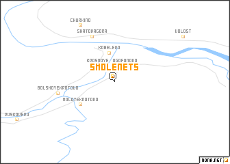
Nearby towns ::
Agafonovo (2.7km north) //
Krasnoye (2.9km north west) //
Kobelëvo (4.7km north) //
Maloye Krotovo (4.4km south west) //
Ust'-Pokshen'ga (7.6km north) //
Shatova Gora (7.6km north) //
[all distances 'as the bird flies' and approximate]  Places with similar names to Smolenets, Russia ::
// Smolnitsa (EE)
// Smolnitsa (BG)
// Zamulintse (UA)
// Smolʼnitsa (BY)
// Smal'nitsa (RU)
// Smolenets (RU)
// Smolenets (RU)
// Smolentsy (RU)
// Smol'nitsy (RU)
Disclaimer :: Information on this page comes without warranty of any kind |
||
|
Where is Smolenets? Elevation and coordinates ::
Latitude (lat): 63°57'0"N Longitude (lon): 44°16'0"E
(map arrows pan, magnifying glasses zoom) |
||
|
Visiting Smolenets? Hotel/Accommodation ::
Book a hotel in Smolenets Travel Guide ::
Buy a travel guide for Russia rental cars ::
car rental offers GPS waypoint ::
download a GPX waypoint (PoI) of Smolenets for your GPS receiver
|
||