|
search place name
|
||
Starina (Smolenskaya Oblast', Russia)Starina is a town in the Smolenskaya Oblast' region of Russia. An overview map of the region around Starina is displayed below.
regional and 3d topo map of Starina, Russia ::
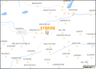
Nearby towns ::
Safonovo (1.4km north) //
Nemoshchenoye (1.6km north west) //
Berëzovka (2.9km north) //
Skalyayeva (4.7km south) //
Prechistoye (2.8km west) //
Boldino (3.3km west) //
Sel'tso (3.2km east) //
Vereshkovichi (3.8km east) //
Puzina (6.9km south) //
Vervishche (7.2km north) //
Staryye Vereshkovichi (5.8km south east) //
Zharovnya (5.7km north east) //
Muzhitskaya (8.4km north) //
Zakharkina (5.4km south east) //
Verdino (8.4km south west) //
Beznosikovo (7.8km south east) //
Gorki (9.1km north east) //
Ruplino (9.5km south east) //
Bor (9.5km north east) //
[all distances 'as the bird flies' and approximate] 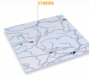 Places with similar names to Starina, Russia ::
Disclaimer :: Information on this page comes without warranty of any kind |
||
|
Where is Starina? Elevation and coordinates ::
Latitude (lat): 55°30'29"N Longitude (lon): 32°21'37"E
Elevation (approx.): 218m (map arrows pan, magnifying glasses zoom) |
||
|
Visiting Starina? Hotel/Accommodation ::
Book a hotel in Starina Travel Guide ::
Buy a travel guide for Russia rental cars ::
car rental offers GPS waypoint ::
download a GPX waypoint (PoI) of Starina for your GPS receiver
|
||