|
search place name
|
||
Staritsa (Kaluzhskaya Oblast', Russia)Staritsa is a town in the Kaluzhskaya Oblast' region of Russia. An overview map of the region around Staritsa is displayed below.
regional and 3d topo map of Staritsa, Russia ::

Staritsa airports ::
The nearest airport is BZK - Bryansk, located 105.8 km south west of Staritsa.
Other airports nearby include VKO - Moscow Vnukovo (234.7 km north east), Nearby towns ::
Obukhovo (3.5km south) //
Fursovo (3.1km south east) //
Ul'yanovo Vtoroye (4.2km south east) //
Ul'yanovo (3.7km south east) //
Ul'yanovo Pervoye (4.2km south east) //
Belyy Verkh (4.7km north east) //
Dubna (5.4km north west) //
Almazovo (6.7km south) //
Rechitsa (4.1km east) //
Medyntsevo (4.4km west) //
Nikitskoye (4.8km north west) //
Pochinok (6.6km north) //
Zhil'kovo (7.0km north) //
Dudorovo (5.9km south west) //
Senichkin (6.8km south west) //
Seraya (7.7km north) //
Yefimtsevo (6.9km north east) //
[all distances 'as the bird flies' and approximate] 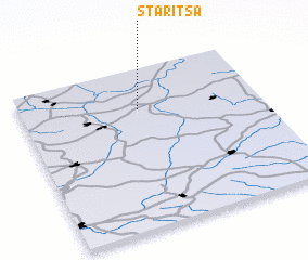 Places with similar names to Staritsa, Russia ::
Disclaimer :: Information on this page comes without warranty of any kind |
||
|
Where is Staritsa? Elevation and coordinates ::
Latitude (lat): 53°44'50"N Longitude (lon): 35°29'49"E
Elevation (approx.): 217m (map arrows pan, magnifying glasses zoom) |
||
|
Visiting Staritsa? Hotel/Accommodation ::
Book a hotel in Staritsa Travel Guide ::
Buy a travel guide for Russia rental cars ::
car rental offers GPS waypoint ::
download a GPX waypoint (PoI) of Staritsa for your GPS receiver
|
||