|
search place name
|
||
Staroye Shchetinovo (Novgorodskaya Oblast', Russia)Staroye Shchetinovo is a town in the Novgorodskaya Oblast' region of Russia. An overview map of the region around Staroye Shchetinovo is displayed below.
regional and 3d topo map of Staroye Shchetinovo, Russia ::

Staroye Shchetinovo airports ::
The nearest airport is KLD - Tver Migalovo, located 204.3 km south east of Staroye Shchetinovo.
Nearby towns ::
Novoye Shchetinovo (1.0km west) //
Churikovo (1.0km west) //
Spirovo (1.9km north) //
Mitroshino (1.9km north) //
Zadneye Selo (2.1km south west) //
Sokirno (1.9km east) //
Ostashëvo (3.8km north) //
Nadozër'ye (2.7km south west) //
Trubino (2.7km south west) //
Kostelëvo (4.2km north east) //
Kozlovo (4.2km north east) //
Ivanova Gora (5.6km north) //
Ozerki (7.4km north) //
Dokhnovo (4.3km north west) //
Chuchemlya (7.5km north) //
Kotovo (7.5km south) //
Myshlyach'ye (7.5km south) //
Rodniki (5.4km north west) //
Klin (8.0km north) //
Staroye Okat'yevo (8.0km south) //
Yemel'yakhnovo (8.4km north east) //
[all distances 'as the bird flies' and approximate] 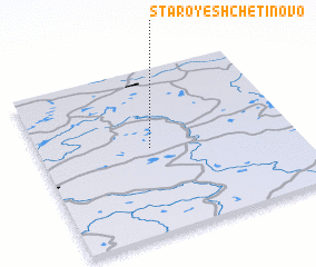 Places with similar names to Staroye Shchetinovo, Russia :: Disclaimer :: Information on this page comes without warranty of any kind |
||
|
Where is Staroye Shchetinovo? Elevation and coordinates ::
Latitude (lat): 58°31'0"N Longitude (lon): 34°26'0"E
Elevation (approx.): 181m (map arrows pan, magnifying glasses zoom) |
||
|
Visiting Staroye Shchetinovo? Hotel/Accommodation ::
Book a hotel in Staroye Shchetinovo Travel Guide ::
Buy a travel guide for Russia rental cars ::
car rental offers GPS waypoint ::
download a GPX waypoint (PoI) of Staroye Shchetinovo for your GPS receiver
|
||