|
search place name
|
||
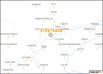
Stretsovo (Novgorodskaya Oblast', Russia)Stretsovo is a town in the Novgorodskaya Oblast' region of Russia. An overview map of the region around Stretsovo is displayed below.
regional and 3d topo map of Stretsovo, Russia ::
Stretsovo airports ::
The nearest airport is VTB - Vitebsk, located 220.8 km south of Stretsovo.
Nearby towns ::
Tychkina (2.3km south east) //
Pustynki Pervyye (2.5km north west) //
Sopki (3.1km north east) //
Pustyn'ki (2.5km north west) //
Makarovo (3.2km north east) //
Makarovo Vtoroye (3.2km north east) //
Gora (4.7km south) //
Mazury (5.7km north) //
Savina (4.6km north east) //
Rabochiy Posëlok (5.9km north) //
Malaya Karavayeva (5.0km south east) //
Bol'shaya Karavayeva (5.0km south east) //
Sutoki (8.3km north) //
Vysokoye (5.6km south west) //
Dunayevo (6.4km south west) //
Tsarëvo (7.7km south) //
Novaya (9.5km south west) //
[all distances 'as the bird flies' and approximate] 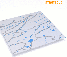 Places with similar names to Stretsovo, Russia ::
Disclaimer :: Information on this page comes without warranty of any kind |
||
|
Where is Stretsovo? Elevation and coordinates ::
Latitude (lat): 57°4'55"N Longitude (lon): 30°56'30"E
Elevation (approx.): 67m (map arrows pan, magnifying glasses zoom) |
||
|
Visiting Stretsovo? Hotel/Accommodation ::
Book a hotel in Stretsovo Travel Guide ::
Buy a travel guide for Russia rental cars ::
car rental offers GPS waypoint ::
download a GPX waypoint (PoI) of Stretsovo for your GPS receiver
|
||