|
search place name
|
||
Tankachëvo (Ryazanskaya Oblast', Russia)Tankachëvo is a town in the Ryazanskaya Oblast' region of Russia. An overview map of the region around Tankachëvo is displayed below.
regional and 3d topo map of Tankachëvo, Russia ::

Nearby towns ::
Shemordino (2.1km north east) //
Sobakino (2.1km south west) //
Akhmatovo (4.3km south west) //
Kotorovo (5.3km south) //
Khalymovo (4.9km south west) //
Kol'dyuki (6.0km north) //
Marsevo (4.9km north east) //
Kryukovo (4.9km south east) //
Shilino (4.3km east) //
Polutino (4.6km south east) //
Selishche (4.6km north west) //
Vatrantsy (5.6km north east) //
Sredniye Barsuki (8.1km north east) //
Chetayevo (8.1km south west) //
Lazarevo (8.6km south east) //
[all distances 'as the bird flies' and approximate] 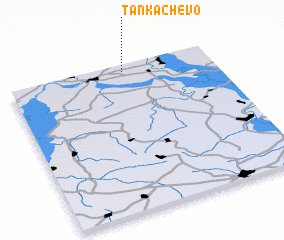 Places with similar names to Tankachëvo, Russia ::
Disclaimer :: Information on this page comes without warranty of any kind |
||
|
Where is Tankachëvo? Elevation and coordinates ::
Latitude (lat): 54°57'0"N Longitude (lon): 41°34'0"E
Elevation (approx.): 158m (map arrows pan, magnifying glasses zoom) |
||
|
Visiting Tankachëvo? Hotel/Accommodation ::
Book a hotel in Tankachëvo Travel Guide ::
Buy a travel guide for Russia rental cars ::
car rental offers GPS waypoint ::
download a GPX waypoint (PoI) of Tankachëvo for your GPS receiver
|
||