|
search place name
|
||
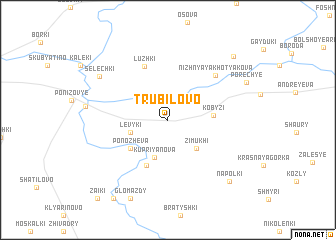
Trubilovo (Smolenskaya Oblast', Russia)Trubilovo is a town in the Smolenskaya Oblast' region of Russia. An overview map of the region around Trubilovo is displayed below.
regional and 3d topo map of Trubilovo, Russia ::
Trubilovo airports ::
The nearest airport is VTB - Vitebsk, located 55.5 km west of Trubilovo.
Nearby towns ::
Levyki (2.8km south west) //
Kupriyanova (4.3km south) //
Zimukhi (3.7km south east) //
Kobyzi (2.9km east) //
Ponozheva (4.0km south west) //
Bor (5.2km south) //
Luzhki (6.2km north) //
Nizhnyaya Khotyakova (5.8km north east) //
Selechki (6.6km north west) //
Glomazdy (9.1km south) //
Porech'ye (6.5km north east) //
Napolki (8.0km south east) //
Verkhnyaya Khotyakova (8.2km north east) //
Fashchëvo (9.4km south) //
Zaiki (9.9km south west) //
[all distances 'as the bird flies' and approximate]  Places with similar names to Trubilovo, Russia ::
// Terebilovo (RU)
// Terebilovo (RU)
// Torbilovo (RU)
// Treblovë (AL)
// Drobylëvo (RU)
// Drbalov (CZ)
// Douar Bel Afia (DZ)
// Douar Bellevue (DZ)
Disclaimer :: Information on this page comes without warranty of any kind |
||
|
Where is Trubilovo? Elevation and coordinates ::
Latitude (lat): 55°15'44"N Longitude (lon): 31°11'16"E
Elevation (approx.): 175m (map arrows pan, magnifying glasses zoom) |
||
|
Visiting Trubilovo? Hotel/Accommodation ::
Book a hotel in Trubilovo Travel Guide ::
Buy a travel guide for Russia rental cars ::
car rental offers GPS waypoint ::
download a GPX waypoint (PoI) of Trubilovo for your GPS receiver
|
||