|
search place name
|
||
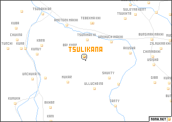
Tsulikana (Dagestan, Russia)Tsulikana is a town in the Dagestan region of Russia. An overview map of the region around Tsulikana is displayed below.
regional and 3d topo map of Tsulikana, Russia ::
Tsulikana airports ::
The nearest airport is MCX - Makhachkala Uytash, located 70.2 km north east of Tsulikana.
Nearby towns ::
Balkhar (3.4km north west) //
Tsuni-Makhi (4.6km north) //
Mukar (5.5km south west) //
Shukty (5.3km south east) //
Ulluchara (6.3km south) //
Urkhuchimakhi (5.8km north east) //
Tebekmakhi (8.4km north) //
Alikhan-Makhi (8.4km north) //
Gapshima (7.3km south east) //
Ameterkmakhi (8.5km north) //
[all distances 'as the bird flies' and approximate] 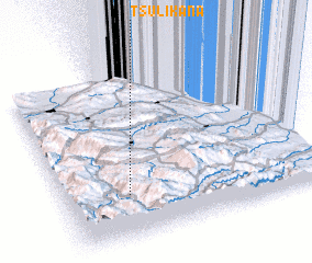 Places with similar names to Tsulikana, Russia ::
// Deislkühn (DE)
// Dželikani (BA)
// Taşlıgüney (TR)
// Taşlıgüney (TR)
// Taşlıgüney (TR)
// Tāsīlkān (IR)
// Tsilkani (GE)
// De Zolken (BE)
// Diasellákion (GR)
// Dousoulékana (CI)
Disclaimer :: Information on this page comes without warranty of any kind |
||
|
Where is Tsulikana? Elevation and coordinates ::
Latitude (lat): 42°15'31"N Longitude (lon): 47°15'10"E
Elevation (approx.): 1747m (map arrows pan, magnifying glasses zoom) |
||
|
Visiting Tsulikana? Hotel/Accommodation ::
Book a hotel in Tsulikana Travel Guide ::
Buy a travel guide for Russia rental cars ::
car rental offers GPS waypoint ::
download a GPX waypoint (PoI) of Tsulikana for your GPS receiver
|
||