|
search place name
|
||
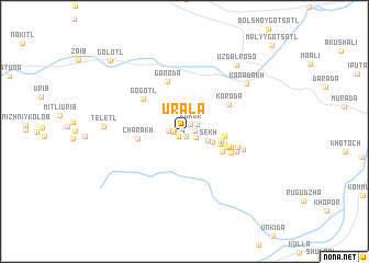
Urala (Dagestan, Russia)Urala is a town in the Dagestan region of Russia. An overview map of the region around Urala is displayed below.
regional and 3d topo map of Urala, Russia ::
Urala airports ::
The nearest airport is MCX - Makhachkala Uytash, located 82.0 km north east of Urala.
Nearby towns ::
Khenda (0.4km north west) //
Mugdab (0.5km south) //
Ivaylazda (0.7km south west) //
Kukor (0.9km north east) //
Khatsunob (0.8km west) //
Tsalada (0.8km east) //
Basar (0.9km west) //
Tlogob (1.0km south east) //
Garbilazda (1.2km north east) //
Baldutl' (1.2km west) //
Sekh (2.0km south east) //
Rosutl' (2.4km south east) //
Ala (2.9km east) //
Lakhnayda (3.0km south east) //
Tsamla (3.0km east) //
Agada (3.3km south east) //
Obonub (3.5km south east) //
Egeda (3.6km south east) //
Amuarib (3.6km south east) //
Charakh (3.6km west) //
Chonob (3.8km south east) //
Khamagib (4.1km south east) //
Koroda (4.3km north east) //
Gogotl' (4.5km north west) //
Gonoda (5.2km north) //
Enseruda (4.4km south east) //
Askhabil'-Kuli (4.3km east) //
Batsikvarikh (4.8km east) //
Karadakh (6.8km north east) //
[all distances 'as the bird flies' and approximate] 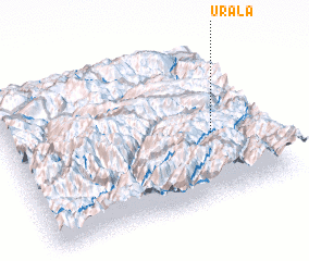 Places with similar names to Urala, Russia ::
Disclaimer :: Information on this page comes without warranty of any kind |
||
|
Where is Urala? Elevation and coordinates ::
Latitude (lat): 42°25'28"N Longitude (lon): 46°48'18"E
Elevation (approx.): 1330m (map arrows pan, magnifying glasses zoom) |
||
|
Visiting Urala? Hotel/Accommodation ::
Book a hotel in Urala Travel Guide ::
Buy a travel guide for Russia rental cars ::
car rental offers GPS waypoint ::
download a GPX waypoint (PoI) of Urala for your GPS receiver
|
||