|
search place name
|
||
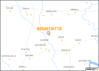
Bogue Chitto (Alabama, United States - USA)Bogue Chitto is a town in the Alabama region of United States - USA. An overview map of the region around Bogue Chitto is displayed below.
regional and 3d topo map of Bogue Chitto, United States - USA ::
Bogue Chitto airports ::
The nearest airport is MXF - Montgomery Maxwell Afb, located 88.3 km east of Bogue Chitto.
Other airports nearby include NMM - Meridian Nas (119.5 km west), BHM - Birmingham Intl (142.4 km north), CBM - Colombus Columbus Afb (177.3 km north west), CEW - Crestview Bob Sikes (190.9 km south east), Nearby towns ::
Eleanor (3.2km south west) //
Salem (4.2km south east) //
Brookwood (5.1km south) //
Westbrook (5.5km south west) //
Martin (5.9km south) //
Marshall (7.9km north) //
Massillon (8.1km north) //
Orrville (8.6km south east) //
Browns (9.8km north west) //
Marion Junction (10.0km north east) //
Blalock (9.8km south west) //
Safford (10.7km south west) //
Bellevue (10.8km north west) //
[all distances 'as the bird flies' and approximate] 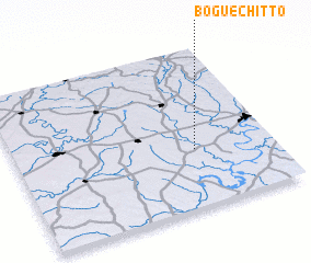 Places with similar names to Bogue Chitto, United States - USA ::
// Bocchetto (IT)
// Bogue Chitto (US)
// Bogue Chitto (US)
// Bokchito (US)
// Bacuachito (MX)
// Bakhsho Ghota (PK)
// Bogosht (PK)
// Bakchet (RU)
// Boksheide (NL)
// Bagshot (AU)
Disclaimer :: Information on this page comes without warranty of any kind |
||
|
Where is Bogue Chitto? Elevation and coordinates ::
Latitude (lat): 32°21'56"N Longitude (lon): 87°18'13"W
Elevation (approx.): 46m (map arrows pan, magnifying glasses zoom) |
||
|
Visiting Bogue Chitto? Hotel/Accommodation ::
Book a hotel in Bogue Chitto Travel Guide ::
rental cars ::
car rental offers GPS waypoint ::
download a GPX waypoint (PoI) of Bogue Chitto for your GPS receiver
|
||