|
search place name
|
||
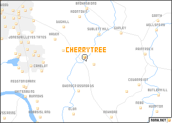
Cherrytree (Alabama, United States - USA)Cherrytree is a town in the Alabama region of United States - USA. An overview map of the region around Cherrytree is displayed below.
regional and 3d topo map of Cherrytree, United States - USA ::
Cherrytree airports ::
The nearest airport is HUA - Redstone Aaf, located 22.3 km west of Cherrytree.
Other airports nearby include CHA - Chattanooga Lovell Fld (121.4 km east), BHM - Birmingham Intl (123.4 km south), ANB - Anniston Metro (129.2 km south east), BNA - Nashville Intl (165.5 km north), Nearby towns ::
Berkley (1.5km south east) //
Big Cove (4.7km north west) //
Sublett Mill (6.4km north) //
Owens Cross Roads (6.5km south) //
Haden (7.3km north west) //
Dug Hill (8.5km north west) //
Gurley (8.8km north east) //
Poplar Ridge (9.8km south east) //
[all distances 'as the bird flies' and approximate] 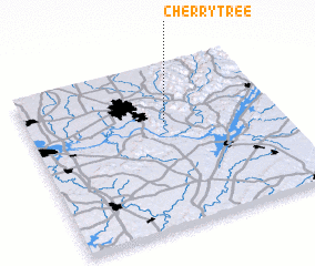 Places with similar names to Cherrytree, United States - USA ::
// Shorter (US)
// Shrader (US)
// Chartoria (UA)
// Shir Darra (IQ)
// Charū Dareh (IR)
// Cherry Tree (US)
// Shrewder (US)
// Cherry Tree (US)
// Cherrytree (US)
// Shrader (US)
Disclaimer :: Information on this page comes without warranty of any kind |
||
|
Where is Cherrytree? Elevation and coordinates ::
Latitude (lat): 34°38'44"N Longitude (lon): 86°26'40"W
Elevation (approx.): 179m (map arrows pan, magnifying glasses zoom) |
||
|
Visiting Cherrytree? Hotel/Accommodation ::
Book a hotel in Cherrytree Travel Guide ::
rental cars ::
car rental offers GPS waypoint ::
download a GPX waypoint (PoI) of Cherrytree for your GPS receiver
|
||