|
search place name
|
||
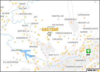
Dogtown (Alabama, United States - USA)Dogtown is a town in the Alabama region of United States - USA. An overview map of the region around Dogtown is displayed below.
regional and 3d topo map of Dogtown, United States - USA ::
Dogtown airports ::
The nearest airport is BHM - Birmingham Intl, located 13.4 km south east of Dogtown.
Other airports nearby include ANB - Anniston Metro (95.2 km east), HUA - Redstone Aaf (119.5 km north), CBM - Colombus Columbus Afb (144.8 km west), MXF - Montgomery Maxwell Afb (144.8 km south), Nearby towns ::
Forestdale Mobile Home Park (0.9km west) //
New Town (1.3km south) //
Scarlet Town (1.3km south west) //
Mineral Springs (1.4km north) //
Republic (1.6km south west) //
Watson (2.2km north) //
Upper Coalburg (3.1km east) //
Coalburg (3.3km south east) //
Forest View Estates (3.9km south) //
Merrywood (3.9km south west) //
Daisey City (3.5km west) //
Hillview (4.3km south) //
Fieldstown (4.1km north east) //
Brookside (4.0km north west) //
Daisey City Trailer Park (3.8km west) //
Westwood Trailer Court (4.1km west) //
Forestdale (5.0km south) //
Frances Heights (4.4km east) //
Hillcrest Estates (4.6km south west) //
Westwood (4.9km south west) //
Crumley Chapel (5.5km south west) //
Pinkney City (4.9km west) //
Cardiff (5.8km north west) //
Crocker Junction (6.5km north) //
Sunset Mountain (6.5km south) //
Walker Chapel (5.7km east) //
Mount Olive (6.8km north) //
Hayes Highland (6.3km south east) //
Blossburg (6.1km west) //
[all distances 'as the bird flies' and approximate] 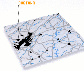 Places with similar names to Dogtown, United States - USA ::
Disclaimer :: Information on this page comes without warranty of any kind |
||
|
Where is Dogtown? Elevation and coordinates ::
Latitude (lat): 33°36'50"N Longitude (lon): 86°53'2"W
Elevation (approx.): 136m (map arrows pan, magnifying glasses zoom) |
||
|
Visiting Dogtown? Hotel/Accommodation ::
Book a hotel in Dogtown Travel Guide ::
rental cars ::
car rental offers GPS waypoint ::
download a GPX waypoint (PoI) of Dogtown for your GPS receiver
|
||