|
search place name
|
||
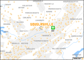
Douglasville (Alabama, United States - USA)Douglasville is a town in the Alabama region of United States - USA. An overview map of the region around Douglasville is displayed below.
regional and 3d topo map of Douglasville, United States - USA ::
Douglasville airports ::
The nearest airport is BHM - Birmingham Intl, located 4.3 km east of Douglasville.
Other airports nearby include ANB - Anniston Metro (87.4 km east), HUA - Redstone Aaf (125.2 km north), MXF - Montgomery Maxwell Afb (136.0 km south), CBM - Colombus Columbus Afb (153.1 km west), Nearby towns ::
Vulcan City (0.5km north) //
Fairfield (1.0km north) //
Village Creek (0.9km west) //
Vanderbilt (1.2km south east) //
Harriman Park (1.4km north) //
East Boyles (1.9km north east) //
Bendale (1.8km north east) //
East Birmingham (1.9km south east) //
Norwood (2.3km south) //
North Birmingham (1.9km west) //
Inglenook (2.2km north east) //
Park Place (2.2km west) //
Ingle Terrace (2.4km north east) //
Bartonville (2.8km north east) //
Boyles Highlands (2.7km north east) //
Avon Park (2.7km east) //
Mountain Park (2.8km north east) //
Lewisburg (3.2km north) //
Washington Heights (2.9km north west) //
Jefferson Hills (3.1km north east) //
Sayreton (3.0km west) //
Kingston (3.2km south east) //
Plain View (3.4km north east) //
Birmingham (3.8km south) //
Zion Heights (3.3km west) //
Oak Park (3.6km north east) //
Franklin Gardens (3.5km west) //
Eastwood (3.5km east) //
Fountain Heights (3.8km south west) //
[all distances 'as the bird flies' and approximate]  Places with similar names to Douglasville, United States - USA ::
// Douglasville (US)
// Douglasville (US)
// Declezville (US)
// Douglasville (US)
// Douglasville (US)
// Douglassville (US)
// Douglassville (US)
Disclaimer :: Information on this page comes without warranty of any kind |
||
|
Where is Douglasville? Elevation and coordinates ::
Latitude (lat): 33°33'15"N Longitude (lon): 86°47'54"W
Elevation (approx.): 174m (map arrows pan, magnifying glasses zoom) |
||
|
Visiting Douglasville? Hotel/Accommodation ::
Book a hotel in Douglasville Travel Guide ::
rental cars ::
car rental offers GPS waypoint ::
download a GPX waypoint (PoI) of Douglasville for your GPS receiver
|
||