|
search place name
|
||
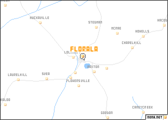
Florala (Alabama, United States - USA)Florala is a town in the Alabama region of United States - USA. An overview map of the region around Florala is displayed below.
regional and 3d topo map of Florala, United States - USA ::
Florala airports ::
The nearest airport is CEW - Crestview Bob Sikes, located 31.2 km south west of Florala.
Other airports nearby include VPS - Valparaiso Eglin Afb (60.9 km south), DHN - Dothan Rgnl (90.8 km north east), PNS - Pensacola Rgnl (101.2 km south west), NPA - Pensacola Nas (119.3 km south west), Nearby towns ::
Lockhart (2.1km west) //
Clear Springs (3.3km south west) //
Paxton (3.3km south east) //
Pleasant Grove (4.8km south west) //
Lakewood (4.8km south east) //
Flowersville (5.8km south) //
Stedman (7.7km north) //
Svea (8.3km south west) //
McRae (8.7km north east) //
[all distances 'as the bird flies' and approximate] 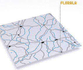 Places with similar names to Florala, United States - USA ::
// Floral (US)
// Floral (US)
// Villarreal (PA)
// Vila Real (PT)
// Fløyrli (NO)
// Floriile (RO)
// Valea Iarului (RO)
// Valea Orlei (RO)
// Valea Orlii (RO)
// Valea Raului (RO)
Disclaimer :: Information on this page comes without warranty of any kind |
||
|
Where is Florala? Elevation and coordinates ::
Latitude (lat): 31°0'18"N Longitude (lon): 86°19'41"W
Elevation (approx.): 84m (map arrows pan, magnifying glasses zoom) |
||
|
Visiting Florala? Hotel/Accommodation ::
Book a hotel in Florala Travel Guide ::
rental cars ::
car rental offers GPS waypoint ::
download a GPX waypoint (PoI) of Florala for your GPS receiver
|
||