|
search place name
|
||
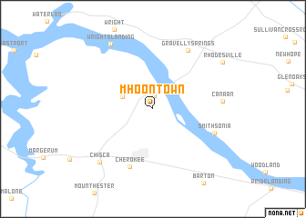
Mhoontown (Alabama, United States - USA)Mhoontown is a town in the Alabama region of United States - USA. An overview map of the region around Mhoontown is displayed below.
regional and 3d topo map of Mhoontown, United States - USA ::
Mhoontown airports ::
The nearest airport is HUA - Redstone Aaf, located 116.7 km east of Mhoontown.
Other airports nearby include MKL - Jackson Mc Kellar Sipes Rgnl (123.5 km north west), CBM - Colombus Columbus Afb (138.3 km south), BHM - Birmingham Intl (177.7 km south east), BNA - Nashville Intl (184.9 km north east), Nearby towns ::
Georgetown (1.6km north) //
Lane Springs (3.4km north west) //
Cherokee (7.5km south) //
Smithsonia (6.9km south east) //
Gravelly Springs (8.1km north east) //
Canaan (7.1km east) //
Chisca (8.4km south west) //
Wrights Landing (9.0km north west) //
Rhodesville (9.0km north east) //
[all distances 'as the bird flies' and approximate] 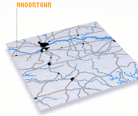
Disclaimer :: Information on this page comes without warranty of any kind |
||
|
Where is Mhoontown? Elevation and coordinates ::
Latitude (lat): 34°49'15"N Longitude (lon): 87°56'50"W
Elevation (approx.): 160m (map arrows pan, magnifying glasses zoom) |
||
|
Visiting Mhoontown? Hotel/Accommodation ::
Book a hotel in Mhoontown Travel Guide ::
rental cars ::
car rental offers GPS waypoint ::
download a GPX waypoint (PoI) of Mhoontown for your GPS receiver
|
||