|
search place name
|
||
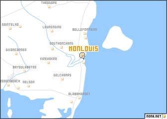
Mon Louis (Alabama, United States - USA)Mon Louis is a town in the Alabama region of United States - USA. An overview map of the region around Mon Louis is displayed below.
regional and 3d topo map of Mon Louis, United States - USA ::
Mon Louis airports ::
The nearest airport is BFM - Mobile Downtown, located 21.0 km north of Mon Louis.
Other airports nearby include MOB - Mobile Rgnl (30.8 km north west), NPA - Pensacola Nas (76.3 km east), BIX - Biloxi Keesler Afb (78.7 km west), PNS - Pensacola Rgnl (88.4 km east), Nearby towns ::
Faustinas (0.7km south) //
Smithport (2.3km north west) //
Bayleys Corner (2.8km north) //
Sunny Cove (4.9km north) //
South Orchard (5.1km north west) //
Bellefontaine (5.9km north) //
Delchamps (6.0km south west) //
Fowl River (6.5km west) //
Kirewakra (6.8km west) //
Alabama Port (8.7km south) //
Laurendine (8.9km north west) //
[all distances 'as the bird flies' and approximate]  Places with similar names to Mon Louis, United States - USA ::
// Mān Lihsaw (MM)
// Mānlisāw (MM)
// Mān Loi-se (MM)
// Mān Lu-hsaw (MM)
// Minhla-asu (MM)
// Minhlasu (MM)
// Minhlazu (MM)
// Minnelusa (US)
// Manlius (US)
// Mainleus (DE)
Disclaimer :: Information on this page comes without warranty of any kind |
||
|
Where is Mon Louis? Elevation and coordinates ::
Latitude (lat): 30°26'25"N Longitude (lon): 88°6'21"W
Elevation (approx.): 11m (map arrows pan, magnifying glasses zoom) |
||
|
Visiting Mon Louis? Hotel/Accommodation ::
Book a hotel in Mon Louis Travel Guide ::
rental cars ::
car rental offers GPS waypoint ::
download a GPX waypoint (PoI) of Mon Louis for your GPS receiver
|
||