|
search place name
|
||
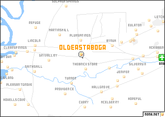
Old Eastaboga (Alabama, United States - USA)Old Eastaboga is a town in the Alabama region of United States - USA. An overview map of the region around Old Eastaboga is displayed below.
regional and 3d topo map of Old Eastaboga, United States - USA ::
Old Eastaboga airports ::
The nearest airport is ANB - Anniston Metro, located 15.2 km east of Old Eastaboga.
Other airports nearby include BHM - Birmingham Intl (68.0 km west), HUA - Redstone Aaf (135.7 km north west), MXF - Montgomery Maxwell Afb (137.3 km south), MGE - Marietta Dobbins Arb (Atlanta Nas) (144.2 km east), Nearby towns ::
Eastaboga (2.2km north) //
The Brick Store (2.5km south) //
Plum Springs (4.2km north) //
Turner (6.0km south) //
Richeytown (5.5km south east) //
Bynum (6.3km north east) //
Martins Mill (6.9km north west) //
Dry Valley (6.4km west) //
Hall Grove (8.5km south east) //
Providence (8.7km south west) //
Grant Town (8.4km south east) //
Burns Crossroad (8.3km north east) //
Munford (9.1km south east) //
[all distances 'as the bird flies' and approximate]  Places with similar names to Old Eastaboga, United States - USA :: Disclaimer :: Information on this page comes without warranty of any kind |
||
|
Where is Old Eastaboga? Elevation and coordinates ::
Latitude (lat): 33°35'11"N Longitude (lon): 86°1'18"W
Elevation (approx.): 172m (map arrows pan, magnifying glasses zoom) |
||
|
Visiting Old Eastaboga? Hotel/Accommodation ::
Book a hotel in Old Eastaboga Travel Guide ::
rental cars ::
car rental offers GPS waypoint ::
download a GPX waypoint (PoI) of Old Eastaboga for your GPS receiver
|
||