|
search place name
|
||
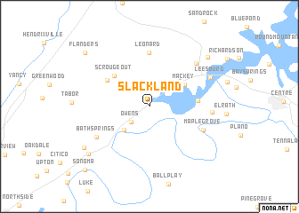
Slackland (Alabama, United States - USA)Slackland is a town in the Alabama region of United States - USA. An overview map of the region around Slackland is displayed below.
regional and 3d topo map of Slackland, United States - USA ::
Slackland airports ::
The nearest airport is ANB - Anniston Metro, located 62.0 km south of Slackland.
Other airports nearby include HUA - Redstone Aaf (98.3 km north west), BHM - Birmingham Intl (107.2 km south west), CHA - Chattanooga Lovell Fld (114.1 km north east), MGE - Marietta Dobbins Arb (Atlanta Nas) (124.0 km east), Nearby towns ::
Owens (2.7km south west) //
Lay Springs (3.4km north west) //
Murrycross (3.9km south west) //
Mackey (4.6km north east) //
Scrougeout (5.2km north west) //
Aubrey Isle (5.1km east) //
Black Creek (5.5km north west) //
Leonard (6.8km north) //
Maple Grove (6.3km south east) //
Bath Springs (6.7km south west) //
Dixon Shop (6.6km east) //
Bristow (7.3km north east) //
Leesburg (7.3km north east) //
Ewing (8.7km north east) //
Turkeytown (8.7km south west) //
Wilsonia (8.6km south west) //
Flanders (9.5km north west) //
Sonoma (10.4km south west) //
[all distances 'as the bird flies' and approximate] 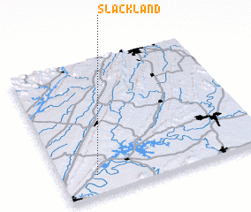 Places with similar names to Slackland, United States - USA :: Disclaimer :: Information on this page comes without warranty of any kind |
||
|
Where is Slackland? Elevation and coordinates ::
Latitude (lat): 34°8'48"N Longitude (lon): 85°49'48"W
Elevation (approx.): 181m (map arrows pan, magnifying glasses zoom) |
||
|
Visiting Slackland? Hotel/Accommodation ::
Book a hotel in Slackland Travel Guide ::
rental cars ::
car rental offers GPS waypoint ::
download a GPX waypoint (PoI) of Slackland for your GPS receiver
|
||