|
search place name
|
||
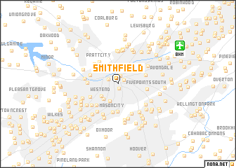
Smithfield (Alabama, United States - USA)Smithfield is a town in the Alabama region of United States - USA. An overview map of the region around Smithfield is displayed below.
regional and 3d topo map of Smithfield, United States - USA ::
Smithfield airports ::
The nearest airport is BHM - Birmingham Intl, located 10.2 km north east of Smithfield.
Other airports nearby include ANB - Anniston Metro (91.8 km east), HUA - Redstone Aaf (130.6 km north), MXF - Montgomery Maxwell Afb (132.5 km south), CBM - Colombus Columbus Afb (149.5 km west), Nearby towns ::
Elyton (0.8km south) //
Graymont (1.0km north east) //
East Thomas (1.3km north) //
Owenton (1.4km north west) //
Fountain Heights (2.7km north east) //
Beverly Station (2.9km south) //
Thomas (3.0km north west) //
West End (3.0km south west) //
Berney Points (3.1km south west) //
East Thomas Gardens (3.2km north west) //
Spaulding (4.4km south) //
Mason City (4.5km south) //
Birmingham (3.9km east) //
Frenchtown (3.9km west) //
Pratt City (4.3km north west) //
Five Points South (4.0km east) //
Germania (4.4km south west) //
The Drifttracks (4.4km north west) //
Central Park Highlands (4.2km south west) //
Ensley (4.1km west) //
Hooper City (5.2km north) //
Edgemont (5.1km south) //
Oakhurst (5.3km north) //
Acipcoville (5.3km north) //
Little Italy (4.5km west) //
Hyde Park (4.9km south west) //
Powderly Hills (5.3km south west) //
Grove Park (4.9km south east) //
Powderly (5.2km south west) //
[all distances 'as the bird flies' and approximate] 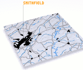 Places with similar names to Smithfield, United States - USA ::
// Smithflat (US)
// Smithfield (US)
// Smithfield (US)
// Smithfield (ZA)
// Smithfield (US)
// Smithfield (US)
// Smithfield (US)
// Smithfield (US)
// Smithfield (US)
// Smithfield (US)
Disclaimer :: Information on this page comes without warranty of any kind |
||
|
Where is Smithfield? Elevation and coordinates ::
Latitude (lat): 33°30'30"N Longitude (lon): 86°50'31"W
Elevation (approx.): 174m (map arrows pan, magnifying glasses zoom) |
||
|
Visiting Smithfield? Hotel/Accommodation ::
Book a hotel in Smithfield Travel Guide ::
rental cars ::
car rental offers GPS waypoint ::
download a GPX waypoint (PoI) of Smithfield for your GPS receiver
|
||