|
search place name
|
||
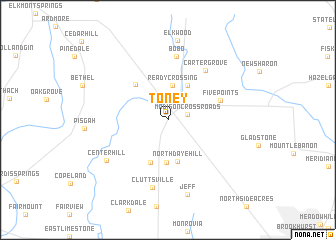
Toney (Alabama, United States - USA)Toney is a town in the Alabama region of United States - USA. An overview map of the region around Toney is displayed below.
regional and 3d topo map of Toney, United States - USA ::
Toney airports ::
The nearest airport is HUA - Redstone Aaf, located 24.7 km south of Toney.
Other airports nearby include BNA - Nashville Intl (136.2 km north), CHA - Chattanooga Lovell Fld (140.5 km east), BHM - Birmingham Intl (148.1 km south), ANB - Anniston Metro (166.2 km south east), Nearby towns ::
Madison Crossroads (1.9km east) //
Ready Crossing (3.9km north) //
Browns Corner (4.3km north east) //
North Daye Hill (4.7km south) //
Hoover (4.8km south) //
Harvest (5.0km south) //
Maple Hill (4.9km north west) //
Five Points (5.3km north east) //
Carter Grove (6.5km north east) //
Bobo (7.2km north) //
Cluttsville (7.6km south) //
Center Hill (7.2km south west) //
Jeff (8.6km south) //
Elkwood (8.9km north) //
[all distances 'as the bird flies' and approximate] 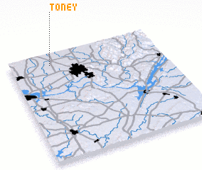 Places with similar names to Toney, United States - USA ::
Disclaimer :: Information on this page comes without warranty of any kind |
||
|
Where is Toney? Elevation and coordinates ::
Latitude (lat): 34°53'53"N Longitude (lon): 86°44'1"W
Elevation (approx.): 254m (map arrows pan, magnifying glasses zoom) |
||
|
Visiting Toney? Hotel/Accommodation ::
Book a hotel in Toney Travel Guide ::
rental cars ::
car rental offers GPS waypoint ::
download a GPX waypoint (PoI) of Toney for your GPS receiver
|
||