|
search place name
|
||
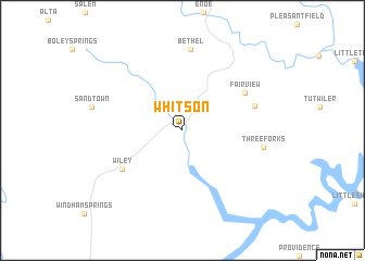
Whitson (Alabama, United States - USA)Whitson is a town in the Alabama region of United States - USA. An overview map of the region around Whitson is displayed below.
regional and 3d topo map of Whitson, United States - USA ::
Whitson airports ::
The nearest airport is BHM - Birmingham Intl, located 60.7 km east of Whitson.
Other airports nearby include CBM - Colombus Columbus Afb (96.5 km west), HUA - Redstone Aaf (140.0 km north east), ANB - Anniston Metro (143.9 km east), NMM - Meridian Nas (155.6 km south west), Nearby towns ::
Wiley (6.5km south west) //
Fairview (6.6km north east) //
Browntown (6.7km east) //
Bethel (8.3km north) //
Three Forks (7.1km east) //
[all distances 'as the bird flies' and approximate] 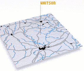 Places with similar names to Whitson, United States - USA ::
Disclaimer :: Information on this page comes without warranty of any kind |
||
|
Where is Whitson? Elevation and coordinates ::
Latitude (lat): 33°34'7"N Longitude (lon): 87°24'28"W
Elevation (approx.): 90m (map arrows pan, magnifying glasses zoom) |
||
|
Visiting Whitson? Hotel/Accommodation ::
Book a hotel in Whitson Travel Guide ::
rental cars ::
car rental offers GPS waypoint ::
download a GPX waypoint (PoI) of Whitson for your GPS receiver
|
||