|
search place name
|
||
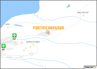
Fort Richardson (Alaska, United States - USA)Fort Richardson is a town in the Alaska region of United States - USA. An overview map of the region around Fort Richardson is displayed below.
regional and 3d topo map of Fort Richardson, United States - USA ::
Fort Richardson airports ::
The nearest airport is EDF - Anchorage Elmendorf Afb, located 6.4 km west of Fort Richardson.
Other airports nearby include MRI - Anchorage Merrill Fld (9.5 km south west), ANC - Ted Stevens Anchorage Intl (18.8 km south west), PAQ - Palmer Muni (49.6 km north east), ENA - Kenai Muni (113.6 km south west), Nearby towns ::
Homesite Park (4.8km south west) //
DeBarr Vista (5.8km south west) //
Nunaka Valley (6.8km south west) //
[all distances 'as the bird flies' and approximate]  Places with similar names to Fort Richardson, United States - USA :: Disclaimer :: Information on this page comes without warranty of any kind |
||
|
Where is Fort Richardson? Elevation and coordinates ::
Latitude (lat): 61°15'16"N Longitude (lon): 149°41'18"W
(map arrows pan, magnifying glasses zoom) |
||
|
Visiting Fort Richardson? Hotel/Accommodation ::
Book a hotel in Fort Richardson Travel Guide ::
rental cars ::
car rental offers GPS waypoint ::
download a GPX waypoint (PoI) of Fort Richardson for your GPS receiver
|
||