|
search place name
|
||
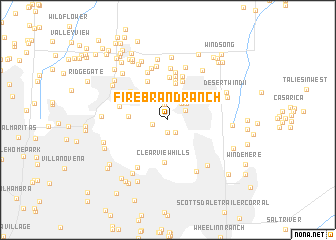
Firebrand Ranch (Arizona, United States - USA)Firebrand Ranch is a town in the Arizona region of United States - USA. An overview map of the region around Firebrand Ranch is displayed below.
regional and 3d topo map of Firebrand Ranch, United States - USA ::
Firebrand Ranch airports ::
The nearest airport is PHX - Phoenix Sky Harbor Intl, located 16.0 km south of Firebrand Ranch.
Other airports nearby include LUF - Phoenix Luke Afb (37.6 km west), PRC - Prescott Ernest A Love Fld (126.2 km north), DMA - Tucson Davis Monthan Afb (187.1 km south east), TUS - Tucson Intl (189.0 km south east), Nearby towns ::
Doubletree Canyon (1.4km south) //
Camelback Estates IV (1.6km south east) //
Sun Valley Mobile Home Park (1.8km north) //
Vista del Cerro (1.6km west) //
Village Fairways (2.0km north) //
Orangetree Estates (1.9km north east) //
Links Point (2.2km north east) //
Woodleaf II (2.5km north east) //
Cobblestone Square (2.9km north) //
Sweetwater Garden (3.2km north) //
Paradise Village North II (4.1km north) //
The Preserve (3.7km west) //
Kensington (4.5km north) //
Greenbrier East (4.5km north) //
Clearview Hills (4.7km south) //
Rancho San Carlos (4.2km north west) //
The Covey (4.8km north) //
Mayflower Terrace (4.7km north west) //
Santiago (5.0km north) //
Hyde Park (5.1km north) //
Shadow Mountain (4.8km north west) //
Shadow Ridge II (5.3km north) //
Stony Mountain Villas (4.8km west) //
Paradise Valley Oasis (5.6km north) //
Quail Valley (5.7km north) //
Cactus (5.1km north west) //
Sandalwood (5.9km north) //
Greenway Park V (6.0km north) //
Montclair Terrace (6.1km north) //
[all distances 'as the bird flies' and approximate]  Places with similar names to Firebrand Ranch, United States - USA :: Disclaimer :: Information on this page comes without warranty of any kind |
||
|
Where is Firebrand Ranch? Elevation and coordinates ::
Latitude (lat): 33°34'36"N Longitude (lon): 111°58'53"W
Elevation (approx.): 423m (map arrows pan, magnifying glasses zoom) |
||
|
Visiting Firebrand Ranch? Hotel/Accommodation ::
Book a hotel in Firebrand Ranch Travel Guide ::
rental cars ::
car rental offers GPS waypoint ::
download a GPX waypoint (PoI) of Firebrand Ranch for your GPS receiver
|
||