|
search place name
|
||
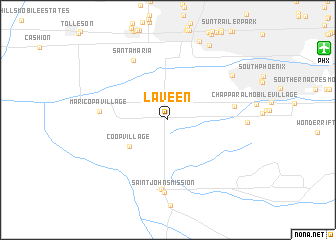
Laveen (Arizona, United States - USA)Laveen is a town in the Arizona region of United States - USA. An overview map of the region around Laveen is displayed below.
regional and 3d topo map of Laveen, United States - USA ::
Laveen airports ::
The nearest airport is PHX - Phoenix Sky Harbor Intl, located 16.6 km north east of Laveen.
Other airports nearby include LUF - Phoenix Luke Afb (27.6 km north west), PRC - Prescott Ernest A Love Fld (145.1 km north), DMA - Tucson Davis Monthan Afb (179.2 km south east), TUS - Tucson Intl (179.9 km south east), Nearby towns ::
Co-op Village (4.6km south west) //
Countryside Mobile Home Park (6.4km east) //
Maricopa Village (6.4km west) //
Santa Maria (7.4km north west) //
Komatke (7.7km south) //
Saint Johns Mission (8.1km south) //
Broadway Trailer Court (7.8km north east) //
Mountain Gate Mobile Home Park (7.4km east) //
Phoenix Acres Trailer Park (9.2km north) //
Blue Bell Mobile Home Park (9.2km north east) //
[all distances 'as the bird flies' and approximate] 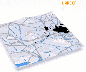 Places with similar names to Laveen, United States - USA ::
Disclaimer :: Information on this page comes without warranty of any kind |
||
|
Where is Laveen? Elevation and coordinates ::
Latitude (lat): 33°21'46"N Longitude (lon): 112°10'7"W
Elevation (approx.): 315m (map arrows pan, magnifying glasses zoom) |
||
|
Visiting Laveen? Hotel/Accommodation ::
Book a hotel in Laveen Travel Guide ::
rental cars ::
car rental offers GPS waypoint ::
download a GPX waypoint (PoI) of Laveen for your GPS receiver
|
||