|
search place name
|
||
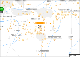
Mission Valley (Arizona, United States - USA)Mission Valley is a town in the Arizona region of United States - USA. An overview map of the region around Mission Valley is displayed below.
regional and 3d topo map of Mission Valley, United States - USA ::
Mission Valley airports ::
The nearest airport is PHX - Phoenix Sky Harbor Intl, located 17.4 km north west of Mission Valley.
Other airports nearby include LUF - Phoenix Luke Afb (53.4 km north west), PRC - Prescott Ernest A Love Fld (153.7 km north), DMA - Tucson Davis Monthan Afb (159.8 km south east), TUS - Tucson Intl (161.5 km south east), Nearby towns ::
Sunridge IV (0.4km west) //
Esplanada (0.4km east) //
New Horizons (0.7km north) //
Womack East (0.7km south west) //
San Carlos (0.8km south) //
Marlborough Mesa (1.0km north) //
Amberwood II (1.0km south east) //
Casa Linda (1.4km south) //
Cloverleaf (1.4km south west) //
Bridgeport (1.5km west) //
Kon Tiki Mobile Home Park (2.0km south) //
Brighton Place (1.9km south west) //
Amberwood (1.9km north west) //
Warner Park (2.2km south) //
Woodglen (1.9km west) //
Cedar Ridge (2.2km south) //
Falfa (1.9km east) //
Tremaine (2.0km east) //
Quail Place (2.1km west) //
Legante Paseo (2.5km north west) //
Evergreen Villa Mobile Home Park (2.7km south) //
Vista Alegre (2.7km north east) //
Silvergate II (2.4km south west) //
Stonegate Crossing (2.7km south east) //
Sun Tech (2.7km south west) //
Keats Crossing (2.9km north) //
Casas del Campo Mobile Home Park (2.9km south east) //
Dobson Ranch (2.9km north west) //
Parkview Mesa (3.2km north) //
[all distances 'as the bird flies' and approximate]  Places with similar names to Mission Valley, United States - USA ::
// Mason Valley (US)
// Masonville (US)
// Masonville (US)
// Missionvale (ZA)
// Masonville (US)
// Masonville (US)
// Masonville (US)
// Masonville (US)
// Masonville (US)
// Masonville (US)
Disclaimer :: Information on this page comes without warranty of any kind |
||
|
Where is Mission Valley? Elevation and coordinates ::
Latitude (lat): 33°21'9"N Longitude (lon): 111°51'5"W
Elevation (approx.): 367m (map arrows pan, magnifying glasses zoom) |
||
|
Visiting Mission Valley? Hotel/Accommodation ::
Book a hotel in Mission Valley Travel Guide ::
rental cars ::
car rental offers GPS waypoint ::
download a GPX waypoint (PoI) of Mission Valley for your GPS receiver
|
||