|
search place name
|
||
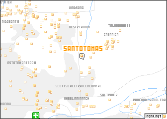
Santo Tomas (Arizona, United States - USA)Santo Tomas is a town in the Arizona region of United States - USA. An overview map of the region around Santo Tomas is displayed below.
regional and 3d topo map of Santo Tomas, United States - USA ::
Santo Tomas airports ::
The nearest airport is PHX - Phoenix Sky Harbor Intl, located 15.5 km south west of Santo Tomas.
Other airports nearby include LUF - Phoenix Luke Afb (43.4 km west), PRC - Prescott Ernest A Love Fld (131.2 km north), DMA - Tucson Davis Monthan Afb (181.2 km south east), TUS - Tucson Intl (183.2 km south east), Nearby towns ::
McCormick Ranch (1.4km east) //
Windemere (2.2km south east) //
Gainey Ranch (2.5km north) //
Heritage Terrace (2.4km north east) //
El Paseo (2.4km north east) //
Las Villas (2.9km south) //
Woodleaf (3.1km south) //
Paradise Valley (3.1km south west) //
Estados de La Mancha II (3.4km north east) //
Country Horizons (3.6km north east) //
Scottsdale (4.6km south) //
Cinco Soles (4.3km south west) //
Buenavante (5.6km north) //
Andalusia (4.9km north east) //
Haciendas del Lago (5.3km north east) //
Mission Monterey (5.4km north east) //
Ensenada del Oro (5.5km north east) //
Desert Wind II (6.3km north) //
Mirador (5.8km north east) //
Camelback Estates IV (5.6km west) //
Preston Hills (6.1km north east) //
Continental Village (5.8km north east) //
Orangetree Estates (6.2km north west) //
Sweetwater Ranch (6.7km north east) //
Scottsdale Ranch (6.2km north east) //
Scottsdale Trailer Corral (7.2km south) //
Woodleaf II (6.6km north west) //
Heritage Court (6.6km north east) //
Doubletree Canyon (6.4km west) //
[all distances 'as the bird flies' and approximate] 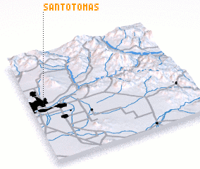 Places with similar names to Santo Tomas, United States - USA ::
// Santo Tomás (PA)
// Santo Tomás (CU)
// Santo Tomás (CU)
// Santo Tomás (CU)
// Santo Tomás (CU)
// Santo Tomás (CU)
// Santo Tomás (CU)
// Santo Tomás (CU)
// Santo Tomás (CU)
// Santo Tomás (CU)
Disclaimer :: Information on this page comes without warranty of any kind |
||
|
Where is Santo Tomas? Elevation and coordinates ::
Latitude (lat): 33°32'54"N Longitude (lon): 111°54'57"W
Elevation (approx.): 398m (map arrows pan, magnifying glasses zoom) |
||
|
Visiting Santo Tomas? Hotel/Accommodation ::
Book a hotel in Santo Tomas Travel Guide ::
rental cars ::
car rental offers GPS waypoint ::
download a GPX waypoint (PoI) of Santo Tomas for your GPS receiver
|
||