|
search place name
|
||
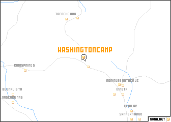
Washington Camp (Arizona, United States - USA)Washington Camp is a town in the Arizona region of United States - USA. An overview map of the region around Washington Camp is displayed below.
regional and 3d topo map of Washington Camp, United States - USA ::
Washington Camp airports ::
The nearest airport is NOG - Nogales Intl, located 32.2 km south west of Washington Camp.
Other airports nearby include FHU - Fort Huachuca Sierra Vista Muni Libby Aaf (40.1 km north east), TUS - Tucson Intl (84.8 km north), DMA - Tucson Davis Monthan Afb (88.9 km north), Nearby towns ::
Duquesne (1.4km south east) //
Lochiel (8.2km south east) //
Guadalupe (9.1km south east) //
Noria de Santa Cruz (8.9km south east) //
Vineta (10.1km south east) //
[all distances 'as the bird flies' and approximate] 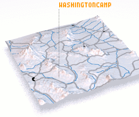 Places with similar names to Washington Camp, United States - USA :: Disclaimer :: Information on this page comes without warranty of any kind |
||
|
Where is Washington Camp? Elevation and coordinates ::
Latitude (lat): 31°22'55"N Longitude (lon): 110°41'26"W
Elevation (approx.): 1636m (map arrows pan, magnifying glasses zoom) |
||
|
Visiting Washington Camp? Hotel/Accommodation ::
Book a hotel in Washington Camp Travel Guide ::
rental cars ::
car rental offers GPS waypoint ::
download a GPX waypoint (PoI) of Washington Camp for your GPS receiver
|
||