|
search place name
|
||
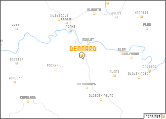
Dennard (Arkansas, United States - USA)Dennard is a town in the Arkansas region of United States - USA. An overview map of the region around Dennard is displayed below.
regional and 3d topo map of Dennard, United States - USA ::
Dennard airports ::
The nearest airport is HRO - Harrison Boone Co, located 79.8 km north west of Dennard.
Other airports nearby include LRF - Jacksonville Little Rock Afb (99.2 km south), LIT - Little Rock Adams Fld (117.2 km south), FYV - Fayetteville Drake Fld (151.1 km west), JBR - Jonesboro Muni (170.0 km east), Nearby towns ::
Rumley (3.7km north) //
Botkinburg (6.5km south) //
Rocky Hill (5.6km south west) //
Noahs (7.0km north) //
Plant (6.9km south east) //
Elba (7.2km east) //
Leslie (8.7km north) //
[all distances 'as the bird flies' and approximate] 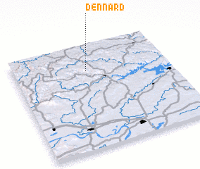 Places with similar names to Dennard, United States - USA ::
// Da-an Norte (PH)
// Downey Road (US)
// Dainrode (DE)
// Tannroda (DE)
// Tanah Rata (MY)
// Dinarta (IQ)
// Denārt (IR)
// Dynard (US)
// Tanarata (ID)
// Dienné Rat (SN)
Disclaimer :: Information on this page comes without warranty of any kind |
||
|
Where is Dennard? Elevation and coordinates ::
Latitude (lat): 35°45'24"N Longitude (lon): 92°31'28"W
Elevation (approx.): 463m (map arrows pan, magnifying glasses zoom) |
||
|
Visiting Dennard? Hotel/Accommodation ::
Book a hotel in Dennard Travel Guide ::
rental cars ::
car rental offers GPS waypoint ::
download a GPX waypoint (PoI) of Dennard for your GPS receiver
|
||