|
search place name
|
||
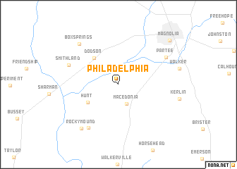
Philadelphia (Arkansas, United States - USA)Philadelphia is a town in the Arkansas region of United States - USA. An overview map of the region around Philadelphia is displayed below.
regional and 3d topo map of Philadelphia, United States - USA ::
Philadelphia airports ::
The nearest airport is ELD - El Dorado South Arkansas Rgnl At Goodwin Fld, located 46.5 km east of Philadelphia.
Other airports nearby include TXK - Texarkana Rgnl Webb Fld (69.0 km north west), BAD - Shreveport Barksdale Afb (84.5 km south west), SHV - Shreveport Rgnl (96.8 km south west), MLU - Monroe Rgnl (141.9 km south east), Nearby towns ::
Macedonia (3.3km south) //
Hunt (5.0km south west) //
Dodson (5.3km north west) //
Harmony (7.9km south west) //
Smithland (7.3km north west) //
Partee (7.6km north east) //
Box Springs (8.3km north west) //
Rocky Mound (8.6km south west) //
Magnolia (9.7km north east) //
[all distances 'as the bird flies' and approximate] 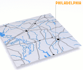 Places with similar names to Philadelphia, United States - USA ::
// Philadelphia (US)
// Philadelphia (US)
// Philadelphia (US)
// Philadelphia (US)
// Philadelphia (US)
// Philadelphia (DE)
// Philadelphia (ZA)
// Philadelphia (US)
// Philadelphia (US)
// Philadelphia (US)
Disclaimer :: Information on this page comes without warranty of any kind |
||
|
Where is Philadelphia? Elevation and coordinates ::
Latitude (lat): 33°12'14"N Longitude (lon): 93°18'43"W
Elevation (approx.): 94m (map arrows pan, magnifying glasses zoom) |
||
|
Visiting Philadelphia? Hotel/Accommodation ::
Book a hotel in Philadelphia Travel Guide ::
rental cars ::
car rental offers GPS waypoint ::
download a GPX waypoint (PoI) of Philadelphia for your GPS receiver
|
||