|
search place name
|
||
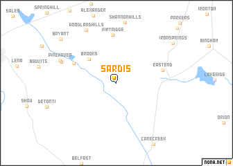
Sardis (Arkansas, United States - USA)Sardis is a town in the Arkansas region of United States - USA. An overview map of the region around Sardis is displayed below.
regional and 3d topo map of Sardis, United States - USA ::
Sardis airports ::
The nearest airport is LIT - Little Rock Adams Fld, located 27.6 km north east of Sardis.
Other airports nearby include LRF - Jacksonville Little Rock Afb (48.8 km north east), ELD - El Dorado South Arkansas Rgnl At Goodwin Fld (150.1 km south), TXK - Texarkana Rgnl Webb Fld (188.9 km south west), FSM - Fort Smith Rgnl (200.1 km north west), Nearby towns ::
Brooks (5.3km north west) //
Goodman (6.5km north west) //
East End (6.5km east) //
Vimy Ridge (7.7km north) //
Lignite (8.0km north west) //
Woodland Hills (9.4km north west) //
[all distances 'as the bird flies' and approximate] 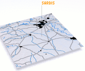 Places with similar names to Sardis, United States - USA ::
Disclaimer :: Information on this page comes without warranty of any kind |
||
|
Where is Sardis? Elevation and coordinates ::
Latitude (lat): 34°31'54"N Longitude (lon): 92°24'28"W
Elevation (approx.): 115m (map arrows pan, magnifying glasses zoom) |
||
|
Visiting Sardis? Hotel/Accommodation ::
Book a hotel in Sardis Travel Guide ::
rental cars ::
car rental offers GPS waypoint ::
download a GPX waypoint (PoI) of Sardis for your GPS receiver
|
||