|
search place name
|
||
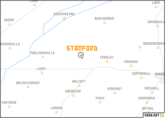
Stanford (Arkansas, United States - USA)Stanford is a town in the Arkansas region of United States - USA. An overview map of the region around Stanford is displayed below.
regional and 3d topo map of Stanford, United States - USA ::
Stanford airports ::
The nearest airport is JBR - Jonesboro Muni, located 29.5 km south of Stanford.
Other airports nearby include BYH - Blytheville Arkansas Intl (66.5 km east), NQA - Millington Rgnl Jetport (109.1 km south east), MEM - Memphis Intl (132.6 km south east), MKL - Jackson Mc Kellar Sipes Rgnl (167.3 km east), Nearby towns ::
Crowley (4.5km east) //
Walcott (6.0km south) //
Ebenezer (8.4km south) //
Beech Grove (9.2km north east) //
Pine Knot (9.7km south east) //
[all distances 'as the bird flies' and approximate] 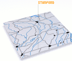 Places with similar names to Stanford, United States - USA ::
// Steinfurt (AT)
// Stanford (US)
// Stonyford (US)
// Stanford (US)
// Stanford (US)
// Stone Fort (US)
// Stonefort (US)
// Stanford (US)
// Steinförde (DE)
// Steinförde (DE)
Disclaimer :: Information on this page comes without warranty of any kind |
||
|
Where is Stanford? Elevation and coordinates ::
Latitude (lat): 36°5'50"N Longitude (lon): 90°39'49"W
Elevation (approx.): 86m (map arrows pan, magnifying glasses zoom) |
||
|
Visiting Stanford? Hotel/Accommodation ::
Book a hotel in Stanford Travel Guide ::
rental cars ::
car rental offers GPS waypoint ::
download a GPX waypoint (PoI) of Stanford for your GPS receiver
|
||