|
search place name
|
||
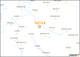
Tuttle (Arkansas, United States - USA)Tuttle is a town in the Arkansas region of United States - USA. An overview map of the region around Tuttle is displayed below.
regional and 3d topo map of Tuttle, United States - USA ::
Tuttle airports ::
The nearest airport is FYV - Fayetteville Drake Fld, located 18.1 km west of Tuttle.
Other airports nearby include HRO - Harrison Boone Co (77.8 km east), FSM - Fort Smith Rgnl (85.2 km south west), TUL - Tulsa Intl (173.5 km west), LRF - Jacksonville Little Rock Afb (206.7 km south east), Nearby towns ::
Mount Olive (4.0km south east) //
Elkins (4.8km south west) //
Wesley (4.7km east) //
Thorney (5.6km south east) //
Goshen (7.7km north) //
Harris (6.8km west) //
Cross Roads (7.4km north east) //
Buckeye (10.3km north east) //
Sulphur City (10.4km south west) //
[all distances 'as the bird flies' and approximate]  Places with similar names to Tuttle, United States - USA ::
Disclaimer :: Information on this page comes without warranty of any kind |
||
|
Where is Tuttle? Elevation and coordinates ::
Latitude (lat): 36°2'1"N Longitude (lon): 93°58'20"W
Elevation (approx.): 382m (map arrows pan, magnifying glasses zoom) |
||
|
Visiting Tuttle? Hotel/Accommodation ::
Book a hotel in Tuttle Travel Guide ::
rental cars ::
car rental offers GPS waypoint ::
download a GPX waypoint (PoI) of Tuttle for your GPS receiver
|
||