|
search place name
|
||
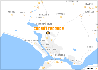
Chabot Terrace (California, United States - USA)Chabot Terrace is a town in the California region of United States - USA. An overview map of the region around Chabot Terrace is displayed below.
regional and 3d topo map of Chabot Terrace, United States - USA ::
Chabot Terrace airports ::
The nearest airport is SUU - Fairfield Travis Afb, located 30.6 km north east of Chabot Terrace.
Other airports nearby include OAK - Metropolitan Oakland Intl (47.3 km south), SFO - San Francisco Intl (59.7 km south), SAC - Sacramento Executive (77.2 km north east), NUQ - Mountain View Moffett Federal Afld (83.0 km south), Nearby towns ::
Flosden Acres (1.3km south west) //
Collins (2.1km north) //
Harry Floyd Terrace (2.1km south) //
Lowell (3.1km north) //
American Canyon (3.3km north west) //
Vallejo (4.9km south) //
Lombard (4.9km north) //
Guadalcanal Village (5.3km south west) //
Squab (6.2km north west) //
South Vallejo (6.6km south) //
Middleton (6.8km north) //
Carquinez Heights (7.9km south) //
Creston (7.8km north east) //
Brazos (8.6km north west) //
Glencove (9.4km south) //
Cuttings Wharf (10.4km north west) //
[all distances 'as the bird flies' and approximate]  Places with similar names to Chabot Terrace, United States - USA ::
// Chūb Derāz (IR)
// Shīb Derāz (IR)
Disclaimer :: Information on this page comes without warranty of any kind |
||
|
Where is Chabot Terrace? Elevation and coordinates ::
Latitude (lat): 38°8'50"N Longitude (lon): 122°14'42"W
Elevation (approx.): 26m (map arrows pan, magnifying glasses zoom) |
||
|
Visiting Chabot Terrace? Hotel/Accommodation ::
Book a hotel in Chabot Terrace Travel Guide ::
rental cars ::
car rental offers GPS waypoint ::
download a GPX waypoint (PoI) of Chabot Terrace for your GPS receiver
|
||