|
search place name
|
||
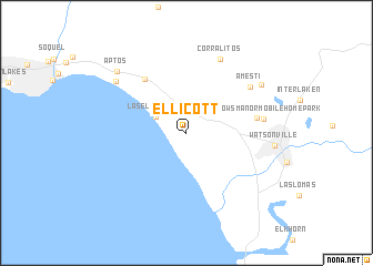
Ellicott (California, United States - USA)Ellicott is a town in the California region of United States - USA. An overview map of the region around Ellicott is displayed below.
regional and 3d topo map of Ellicott, United States - USA ::
Ellicott airports ::
The nearest airport is SJC - Norman Y Mineta San Jose Intl, located 49.6 km north of Ellicott.
Other airports nearby include NUQ - Mountain View Moffett Federal Afld (58.1 km north), SFO - San Francisco Intl (91.0 km north west), OAK - Metropolitan Oakland Intl (95.1 km north), MOD - Modesto City Co Harry Sham (110.5 km north east), Nearby towns ::
La Selva Beach (3.0km north west) //
Rob Roy Junction (6.4km north west) //
Freedom (5.9km east) //
Meadows Manor Mobile Home Park (6.4km east) //
Amesti (6.9km north east) //
Corralitos (7.9km north) //
Rio Del Mar (7.7km north west) //
Strongs Mobile Village (7.7km north east) //
Watsonville (7.2km east) //
Aptos (8.3km north west) //
[all distances 'as the bird flies' and approximate]  Places with similar names to Ellicott, United States - USA ::
Disclaimer :: Information on this page comes without warranty of any kind |
||
|
Where is Ellicott? Elevation and coordinates ::
Latitude (lat): 36°55'18"N Longitude (lon): 121°50'9"W
Elevation (approx.): 62m (map arrows pan, magnifying glasses zoom) |
||
|
Visiting Ellicott? Hotel/Accommodation ::
Book a hotel in Ellicott Travel Guide ::
rental cars ::
car rental offers GPS waypoint ::
download a GPX waypoint (PoI) of Ellicott for your GPS receiver
|
||