|
search place name
|
||
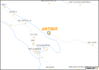
Jimtown (California, United States - USA)Jimtown is a town in the California region of United States - USA. An overview map of the region around Jimtown is displayed below.
regional and 3d topo map of Jimtown, United States - USA ::
Jimtown airports ::
The nearest airport is SUU - Fairfield Travis Afb, located 89.8 km south east of Jimtown.
Other airports nearby include SMF - Sacramento Intl (106.9 km east), SAC - Sacramento Executive (116.7 km east), OAK - Metropolitan Oakland Intl (117.3 km south east), SFO - San Francisco Intl (122.6 km south), Nearby towns ::
Del Rio Woods (5.1km south) //
Lytton (4.6km west) //
Camp Rose (5.8km south) //
Simi (5.6km south west) //
Chiquita (5.9km south west) //
Bailhache (7.6km south west) //
Healdsburg (7.6km south west) //
Grant (8.8km south) //
[all distances 'as the bird flies' and approximate] 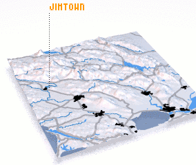 Places with similar names to Jimtown, United States - USA ::
Disclaimer :: Information on this page comes without warranty of any kind |
||
|
Where is Jimtown? Elevation and coordinates ::
Latitude (lat): 38°40'0"N Longitude (lon): 122°49'7"W
Elevation (approx.): 55m (map arrows pan, magnifying glasses zoom) |
||
|
Visiting Jimtown? Hotel/Accommodation ::
Book a hotel in Jimtown Travel Guide ::
rental cars ::
car rental offers GPS waypoint ::
download a GPX waypoint (PoI) of Jimtown for your GPS receiver
|
||